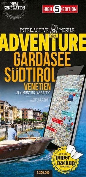
High 5 Edition Interactive Mobile ADVENTUREMAP Gardasee Südtirol - "Adventure"-Karte Gardasee Südtirol 1:200 000. 1 : 200.000
| Verlag | High 5 Edition |
| Auflage | 2018 |
| Format | 11,6 x 23,8 x 0,9 cm |
| Mehrfarbdendruck. Gefalzt | |
| Gewicht | 120 g |
| Artikeltyp | Karte |
| Reihe | High 5 Edition ADVENTURE Collection |
| ISBN-10 | 3906908666 |
| EAN | 9783906908663 |
| Bestell-Nr | 90690866A |
The first water-resistant adventuremap with direct access to useful additional information from the Internet
The region of Lake Garda / South Tyrol in a scale of 1:200,000 shown on a practical map. With the High 5 Edition app you can display adventures directly on the map. Thanks to filter functions you can adapt the displayed adventures to your needs. Just one click takes you selectively to TripAdvisor or to the website of the provider of the adventure, where you can find lots of useful information and guest reviews or even (if available) book your tickets. You can profit from the clear arrangement of the map as well as from always up-to-date information, the unmatched quantity of data and the wealth of information.
Thanks to its practical format (11.4 x 23.5 cm) as well as its indestructibility and water resistance thanks to lamination/cellophane coating, the "ADVENTUREMAP Lake Garda / South Tyrol" is suitable for any adventure.
The "Interactive Mobile A DVENTUREMAP Lake Garda / South Tyrol" - a "paper backup" just in case...
... and when used in conjunction with a smartphone, it is a great tool for planning trips.
What's not on the map is in the app
Besides information about adventures you can also gather information about major attractions and cities in the region of Lake Garda / South Tyrol, see the current weather forecasts and project your own photos on the map. The High 5 Edition app is based on Augmented Reality technology and is available free of charge from the Apple App store and Google Play store. More information on www.high5edition.com

